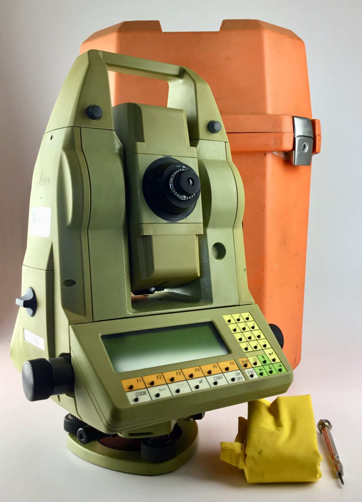
Modern Mobile Mapping systems make it very easy to quickly map large areas. Current laser scanners with pulse rates of 1 MHz and above make it possible to achieve sufficient point density even at highway driving […]
admin
103 posts
There were times when programmers did not have to worry about parallelisation, as most computers only had a single CPU. Sure, you could get dual-CPU mainboards, but their use was mostly limited to servers. The need […]
I’ve long been interested in using game engines as tool for visualising and analyzing geographic information. A couple of years ago I played with Unity. I liked how well integrated with C# it was and how […]
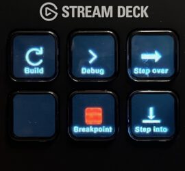
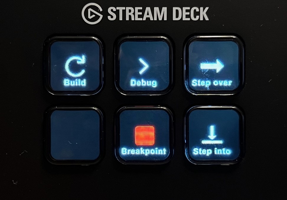
I’ve recently acquired an Elgato Stream Deck Mini after reading about it in German computer magazine C’t. For those who are not familiar with the Stream Deck, it’s essentially a programmable macro pad, but with the […]
This article is available in three languages, so make sure to choose your preferred language on the right. 2024 is a lustrum (five-year anniversary) year for me. And I’m not talking about the 70th birthday of […]
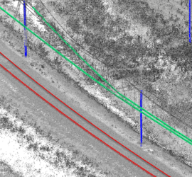
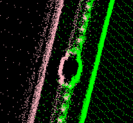
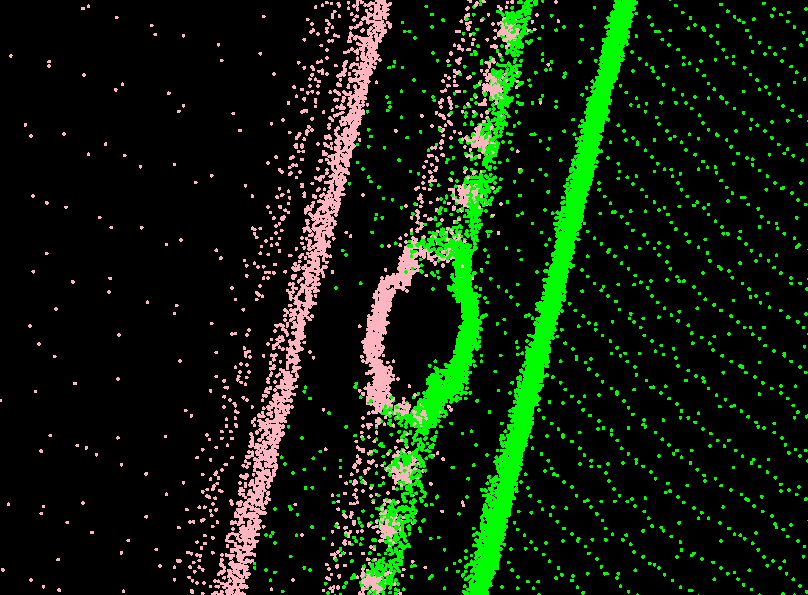
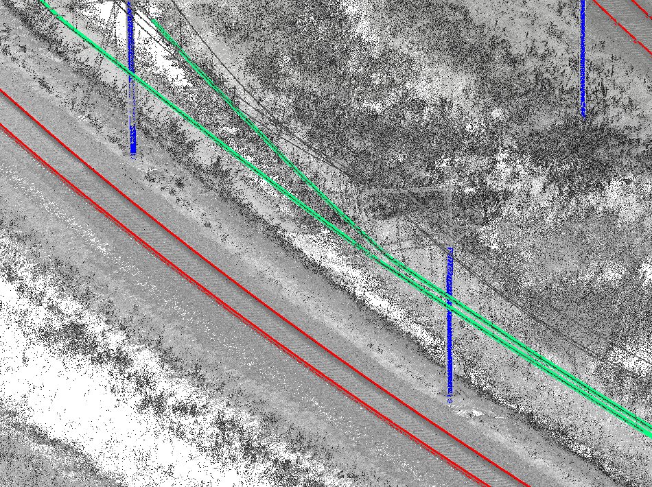
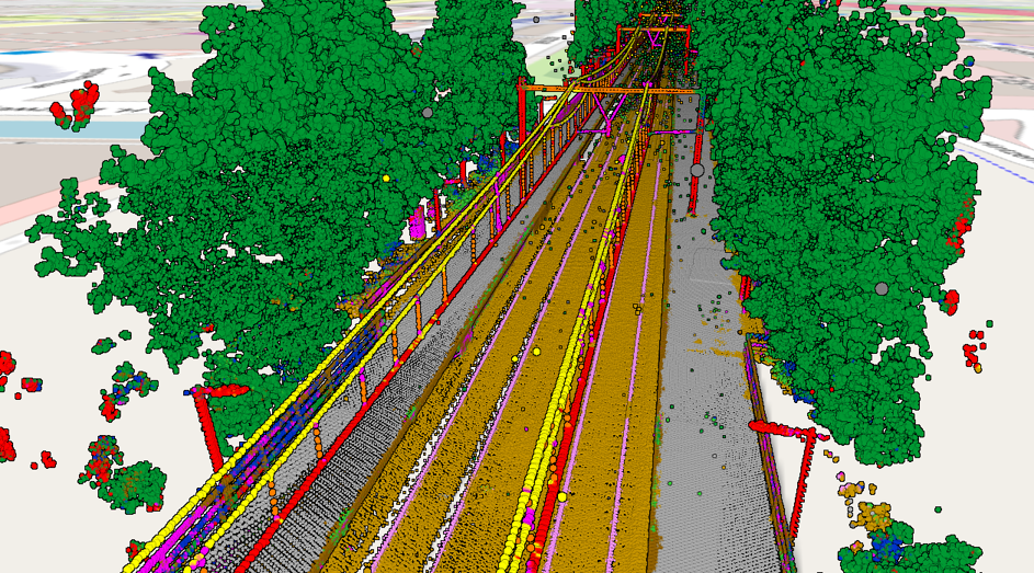
Point clouds acquired through laser scanning with mobile mapping systems mounted on rail vehicles have become the de-facto standard for efficient large-scale mapping of rail infrastructure. Unfortunately, point clouds are large and unstructured heaps of data […]
I started coding with Basic (on the Commodore 64, of course), but I consider myself mostly a C++ programmer. That’s the language I used throughout my time as university student and that I still use for […]
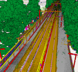
Okay, let’s be honest: Despite what the manufacturers of laser scanning equipment are trying to tell us, nobody really wants point clouds. They are huge blobs of unstructured and often noisy data with a low semantic […]

Linux/Windows dual boot works fine, but there are cases where this is not feasible. A computer may have to do most of its work under Windows because of certain application. When Linux is required, the Windows […]